Geoprocessing and Archiving of Historical Aerial Images
More and more countries have digitized or are currently digitizing their archives of aerial images. They are a unique and relatively unexplored means to chronicle land-cover information over the past 100 years with very high spatial resolution. Such data provide a relatively dense temporal sampling of the territories. 3D information can even be retrieved since many surveys were performed under photogrammetric conditions. Therefore, both long-term environmental monitoring studies and historical object detection can be based on the analysis of these very rich time series of images.
We have noticed in the last years an increasing number of scientific papers processing historical airborne images in parallel to an increasing effort of local and national mapping authorities for creating the most complete archives. In a timely manner, it appears necessary to evaluate the current status of the archive digitization process in Europe (from geoferencing to distribution policies) as well as to review current application fields.
This EuroSDR event took place at IGN in Paris, France. Presentations were made by representatives from industry, NMCAs and academia.
The workshop report can be downloaded here.
If you have any questions about this workshop, please contact Clément Mallet (Clement.Mallet@ign.fr) or Sébastien Giordano (Sebastien.Giordano@ign.fr).
Final program (pdf)
Day 1 - June 3rd, 2019 | |
12:00 | Lunch and registration |
13:00 | Welcome address and introduction to EuroSDR |
Session 1: The process of digitizing and archiving | |
13:10-14:30 | Archiving of historical aerial images: current status in Europe (pdf) |
| The digital transformation of the National Collection of Aerial Photography (NCAP): achievements to-date & next stage (pdf) |
| Preservation and digitizing of historical aerial images in Norway (pdf) |
| Analog/digital image processing of historical aerial imagery in the Italian National Photographic Aerial Archive (AFN-ICCD) (pdf) |
14:30-14:45 | Coffee/tea break |
Session 2: R&D in geoprocessing historical images Archiving and geoprocessing | |
14:45-16:15 | Towards fully automatic orthophoto & DSM generation (pdf) |
| Machine learning methods applied to WWII aerial images (pdf) |
| Experiences with processing and co-registration of archival image datasets (pdf) |
| Using point clouds from historical imagery for estimating site index in forestry (pdf) |
16:15-16:30 | Coffee/tea break |
Session 3: Geoprocessing and use cases | |
16:30-17:30 | Tracasa feedback on scanning and orthophoto generation (pdf) |
| Making it digital - Processing the aerial image archive of Sweden (pdf) |
| The digitization of IGN’s photo/cartographic archives and the web service “Remonter le temps” (“Go back in time”) (pdf) |
| Time Machine. Big Data of the Past for the Future of Europe |
17:30 | Closure of meeting day 1 |
20:00 | Get-together dinner |
Day 2 - June 4th, 2019 | |
Session 4: Geoprocessing and use cases | |
08:15-08:30 | Coffee/tea |
08:30-10:30 | Historical orthophoto of Prague 1945 (pdf) |
| Historical aerial images of Czechia - archiving and applications in landscape studies (pdf) |
| 3D Glacier monitoring with historical aerial images - from 1953 to today (pdf) |
| Historical Digital Ortho of entire Lombardia region (pdf) |
| A journey through time: Digitizing, processing and publishing historical aerial imagery in Switzerland (pdf) |
10:30-11:00 | Coffee/tea break |
Session 5: R&D in geoprocessing historical images | |
11:00-12:00 | Marked point processes for the automatic detection of bomb craters in aerial wartime images (pdf) |
| Automatic land cover reconstruction from historical aerial images: an evaluation of features extraction and classification algorithms (pdf) |
| Automatic orientation of terrestrial and aerial archival images |
12:00 | Wrap up discussions / Recommendations for further work |
12:30 | End of meeting / Lunch |
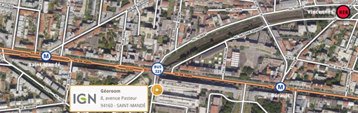
Venue
IGN Géoroom
(Just 50m away from the IGN headquarter entrance)
8 avenue Pasteur
94165 Saint-Mandé
France
map
Accommodation
An overview of hotels near IGN France can be found here.
Organized by
Sébastien Giordano (IGN France)
Clément Mallet (IGN France)
Fabio Remondino (FBK Trento, Italy)
Jon Arne Trollvik (NMA Norway)
Registration form